Getting Around Sydney
Sydney has trains, Metro services, buses, ferries and light rail, but the best option depends on where you are travelling. This guide explains how the network works, how to pay and which detailed transport guide to use next.
Practical transport information last checked:
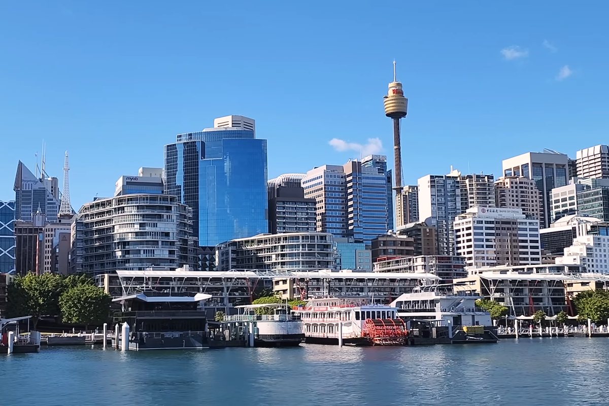
Sydney’s public transport network includes trains, Metro services, buses, ferries and light rail. Most visitors can explore the city without a car, particularly when staying near the CBD, Circular Quay, a major railway station or a Metro stop.
The best transport mode depends on the journey. Trains and Metro services are useful for many longer urban trips, ferries cross the harbour, buses reach beaches and suburbs without rail, and light rail serves selected central and inner-city areas.
Quick answer
- Most central Sydney trips
- Train, Metro or light rail, depending on the route
- Harbour destinations
- Ferry
- Bondi Beach
- Train plus bus from many CBD starting points; check the complete trip
- Manly
- Ferry or bus, depending on where you start and current conditions
- Sydney Airport
- Airport train for many visitors; taxi or rideshare can suit groups and heavy luggage
- Beaches without rail access
- Bus
- Short central journeys
- Walking, light rail or train
- Payment for most adult visitors
- Contactless bank card or compatible device
- Is a car necessary?
- Usually not for a central Sydney visit
Sydney transport at a glance
- Main public transport modes
- Train, Metro, bus, ferry and light rail
- Main journey-planning tool
- Transport for NSW Trip Planner
- Payment
- Opal or contactless payment on eligible services
- One payment method per passenger
- Yes
- Car required for a central visit
- Usually no
- Airport connections
- Train, taxi, rideshare, bus combinations and private transfers
- Service changes
- Check alerts and planned work before travelling
- Accessibility
- Plan stations, stops, wharves, vehicles and connecting paths
Choose a transport mode
Public transport
Arrivals and departures
Other ways to travel
Choosing a transport mode
| Mode | Best for | Main advantage | Main drawback | Payment |
|---|---|---|---|---|
| Train | Longer city and suburban trips | Broad network | Trackwork and station access vary | Opal or contactless |
| Sydney Metro | Current Metro corridors | Frequent, high-capacity services | Does not cover every visitor destination | Opal or contactless |
| Bus | Beaches and places without rail | Broad local reach | Traffic dependent | Opal or contactless |
| Ferry | Harbour and river destinations | Useful transport with harbour views | Weather, tides and capacity can affect services | Opal or contactless on Sydney Ferries |
| Light rail | Selected central and inner-city routes | Street-level stops | Limited geographic coverage | Opal or contactless |
| Walking | Central attractions | Free and flexible | Hills, heat and distance | No fare |
| Taxi | Door-to-door travel | Convenient with luggage | Traffic and cost | Taxi fare and payment rules |
| Rideshare | App-booked door-to-door travel | Pickup and destination in the app | Variable pricing and pickup zones | Operator payment |
| Private transfer | Pre-arranged pickup | Confirmed meeting arrangement | Usually requires booking | Operator payment |
| Car | Selected suburbs and regional trips | Flexibility | Parking, congestion and tolls | Road, toll and parking costs |
How Sydney public transport works
Transport for NSW coordinates Metro, train, bus, ferry and light-rail travel across Sydney, although different companies may operate particular services. Major interchanges such as Central, Town Hall, Wynyard and Circular Quay connect several modes.
Use the Trip Planner for a date-specific route. Stopping patterns and frequency vary by route, time and day. Planned work, events and disruptions can change normal platforms, stops or wharves. Check the outward and return journeys, especially late in the day.
Private ferries, tourist buses, cruises and transfers may not use Opal fares or public-transport ticketing.
How to pay for Sydney public transport
Most adult visitors can use a contactless debit or credit card, phone or compatible wearable on eligible public transport services. Use the same card or device to tap on and tap off. An Adult Opal card is another option.
Contactless payment normally applies the appropriate Adult Opal fare and benefits. Eligible concession travellers can link certain entitlements before travel, but Child/Youth and Gold Senior/Pensioner fares require the appropriate Opal card. Opal single tickets are a back-up on Metro, train, ferry and light rail, not ordinary bus services.
The airport station access fee is added separately when using the airport train stations. Private operators and OpalPay services may have different prices and benefits. Check current contactless guidance and current fare rules. Last checked: 13 July 2026.
Where and how to get an Opal card
For most adult visitors, an accepted contactless bank card or device is the simplest option. If you prefer an Opal card, Adult and Child/Youth cards are available over the counter from participating Opal retailers, including many convenience stores and newsagents. They can also be obtained from selected Transport Customer Service Centres and Service NSW locations, or ordered online through the Opal website.
- Choose the correct card: Adult cards are for people aged 16 or older. Child/Youth cards are for eligible children and school students. Concession and Gold Senior/Pensioner cards have eligibility requirements and normally require an online application.
- Find a seller: use the official Get an Opal card page to find a participating retailer or the correct application route.
- Add value before travelling: the card itself is free, but it must have enough value for the journey. Top up at a retailer or Opal top-up machine, through the Opal Travel app, or online. For immediate travel, top up in person because online top-ups can take up to 60 minutes.
- Tap on and tap off: use the same Opal card at both ends of the journey. Each fare-paying passenger needs their own card or payment method.
See the official Opal top-up guidance for current options and processing times.
Trains and Sydney Metro
Sydney Trains operates the suburban rail network. Sydney Metro is a separate automated railway with level access between platforms and trains. The Metro currently connects the north-west, Chatswood, the CBD and Sydenham, with city stations including Barangaroo, Martin Place, Gadigal, Central and Waterloo.
Central, Town Hall, Wynyard and other major stations are useful interchanges, but the closest station depends on the destination. Check the platform, stopping pattern and whether the service is express or all stations. Planned trackwork often changes routes outside busy periods, particularly at night and on weekends.
Airport trains use the suburban network and include a station access fee. Suburban trains do not provide reserved luggage storage. For accessible travel, check the station facilities, lift status and boarding arrangements for the whole route.
Sydney buses
Buses reach many beaches, suburbs and attractions that do not have direct rail access. From many CBD starting points, Bondi Beach normally involves a train to Bondi Junction followed by a bus, although the best route depends on the exact origin and current service conditions. Buses are also important for the Northern Beaches and local connections from stations.
Use the Trip Planner to identify the correct stop and direction. Route numbers, stops and diversions can change, and journey times depend on traffic. Tap on and tap off where required. Signal clearly when you want the bus to stop, keep luggage and prams out of aisles, and check whether the selected vehicle and stop meet accessibility needs.
Sydney ferries
Public Sydney Ferries services are normal public transport and accept Opal and contactless payment. Circular Quay is the main visitor interchange for ferries to destinations including Manly, Taronga Zoo, Watsons Bay and Cockatoo Island. Services also operate along the Parramatta River.
Public ferries are different from private ferries and harbour cruises. Wharf allocations can change, and weather, low tide, incidents or capacity limits can affect travel. Confirm the return service and accessibility of both wharves and the final walking route.
Sydney light rail
Sydney’s L1 Dulwich Hill Line runs between Central Grand Concourse and Dulwich Hill via Darling Harbour and the inner west. L2 and L3 run from Circular Quay through George Street, Central and Surry Hills towards Randwick or Juniors Kingsford.
Light rail uses street-level stops and is separate from Sydney Metro. Check the destination and platform before boarding, then tap on and off. Traffic, major events and trackwork can affect frequency or require replacement arrangements. Check the selected stop and connecting path for accessibility.
Sydney Airport to the city
The airport train is usually the most predictable choice for one or two travellers staying near a station. Taxi can suit families, groups, heavy luggage or accommodation away from rail. Rideshare provides app-booked door-to-door travel with variable pricing. Bus and train combinations can cost less but take longer and are less convenient with luggage. A private transfer can provide a pre-arranged meeting point.
The airport train stations add an access fee to the normal rail fare. Pickup areas differ between terminals and transport types.
Walking around central Sydney
Many CBD and harbour attractions can be combined on foot, including Circular Quay with The Rocks or the Opera House, and parts of Barangaroo with Darling Harbour. Maps can understate the effort because Sydney has hills, level changes and large interchanges.
Heat, rain, limited shade, controlled road crossings and construction detours can affect a walk. Accessibility depends on gradients, surfaces, kerb ramps and the exact entrance. Walking combines well with ferries, trains and light rail, but not every central destination is a short walk.
Driving and parking in Sydney
A car is usually unnecessary for a central Sydney visit. Congestion, clearways, loading restrictions, electronic toll roads and expensive or limited parking can make short road journeys slower than expected. Beach and event parking can fill early, and parking signs must be read carefully.
A car can be useful for selected outer-suburban or regional trips, but many day-trip destinations also have public transport. If hiring a car, confirm how tolls are charged and where it can be legally parked.
Taxis and rideshare
Taxis and rideshare can be useful for door-to-door travel, heavy luggage or reduced mobility. Both are affected by traffic, but their fare systems differ. Rideshare prices can rise during high demand, while taxi fares follow regulated charging arrangements.
Airports and major events may use dedicated pickup areas. Accessible taxis or vehicles with child restraints may require advance planning and should not be assumed immediately available. Follow official rank signs or the operator’s pickup instructions.
Getting around Sydney late at night
Frequency decreases on many routes late at night, and last services vary by line and day. NightRide buses replace most Sydney train services between midnight and 4:30 am, while selected regular buses, Metro services and other transport may operate later.
Use the Trip Planner rather than assuming a daytime route runs overnight. Check the complete late-night journey before leaving, including the final connection from the station, stop or wharf to your accommodation. Taxi and rideshare remain alternatives when public transport does not suit.
Transport to Sydney cruise terminals
Sydney’s main cruise terminals are the Overseas Passenger Terminal at Circular Quay and White Bay Cruise Terminal at Balmain. Confirm the berth with the cruise operator because the transport plan is different for each terminal.
The Overseas Passenger Terminal is close to Circular Quay trains, light rail, ferries and buses. White Bay does not have direct train access and has more limited public transport; taxi, rideshare, arranged transfer or current event transport may be more practical with luggage. Ship days can create road congestion. Check terminal access, departure time and the complete airport connection in advance.
Accessible transport in Sydney
Plan accessibility as a complete journey. Check station and platform access, lift status, stops, wharves, boarding assistance, vehicles, interchange paths and the final route to the destination. An accessible vehicle does not guarantee that the destination stop, wharf or connecting path is accessible.
The Trip Planner can filter for accessible services and stops, but temporary lift outages, construction and replacement transport can still change the result. Review live alerts and ask staff for boarding help where needed.
- Plan
- Use the accessible-service filter in Trip Planner
- Check
- Stations, stops, wharves, lifts and final paths
- Before departure
- Review alerts and temporary access changes
Public transport with children
Children who need a fare require an eligible ticket or Opal card; do not assume an adult contactless card produces a child fare. Children aged three and under travel free. Each fare-paying passenger needs a separate payment method.
Prams are free on public transport. Apply the brake, supervise children near platforms and wharves, keep doors and aisles clear, and use lifts where available. Crowded buses and ferries may be difficult with both prams and luggage. If comparing a taxi or rideshare, confirm child-restraint requirements and availability from current official guidance.
Luggage, bicycles and bulky items
Ordinary luggage is manageable on most services when it is kept under control and does not block doors, aisles or emergency access. Peak trains and buses can be difficult with large bags, and airport trains are suburban services rather than dedicated luggage trains.
Bicycles are not allowed on buses, including train-replacement buses. They can travel free on Metro, Sydney and Intercity trains, Sydney Ferries and Sydney light rail when there is safe space, subject to staff instructions. Private ferries and regional services use different rules. Check current restrictions for e-bikes, batteries and other bulky items before travel.
Check transport alerts before travelling
Planned trackwork, Metro maintenance, road diversions, ferry disruption, light-rail changes, major events, severe weather, lift outages and temporary station or wharf closures can change a journey. Replacement transport may use different stops and may not carry every bulky item.
Common visitor journeys
| Journey | Usually practical option | Alternative | Important consideration |
|---|---|---|---|
| Sydney Airport to CBD | Airport train | Taxi, rideshare, bus connection or transfer | Airport station access fee and terminal pickup areas |
| Circular Quay to Manly | F1 public ferry | Bus or private ferry | Public and private fares differ; check the return |
| CBD to Bondi Beach | Train to Bondi Junction plus bus from many origins | Direct bus options depending on origin | Traffic and the exact starting point matter |
| CBD to Taronga Zoo | F2 ferry from Circular Quay | Bus connections | Zoo entry is separate and the site rises uphill |
| CBD to Darling Harbour | Walk or light rail depending on origin | Train plus walk | Choose the closest side of the precinct |
| CBD to Parramatta | Train for speed | F3 ferry for a longer scenic journey | Low tide can alter some ferry services |
| CBD to Blue Mountains | Intercity train | Car or organised tour | Check trackwork and the final local connection |
| CBD to White Bay Cruise Terminal | Taxi, rideshare or arranged transfer with luggage | Current bus and walking combinations | No direct train access; confirm the berth |
| Circular Quay to Barangaroo | Walk, Metro or ferry depending on destination | Light rail and walk | Barangaroo covers a large area |
| Central Station to Circular Quay | Train or light rail | Walk or bus | Choose the mode nearest your station exit and destination |
Common transport mistakes to avoid
- Using one bank card for several people: each passenger needs a separate valid payment method.
- Tapping on with one device and off with another: use the same card or device throughout.
- Assuming all transport operates all night: check the last complete journey.
- Relying on an old route or wharf number: use current Trip Planner results and displays.
- Treating private transport as part of the Opal network: fares and payment may differ.
- Getting off at the first central station: another station may be closer.
- Planning only the outward trip: return services may be less frequent.
- Assuming a car is faster in the CBD: congestion and parking can remove the advantage.
- Assuming every station, stop or wharf is accessible: check the whole route.
- Leaving no transfer time: large interchanges involve walking.
- Depending on an exact timetable during events: crowding and temporary changes can affect travel.
Frequently asked questions
Do I need an Opal card in Sydney?
Can I use a contactless bank card?
Can one card pay for several passengers?
Is Sydney easy to visit without a car?
What is the difference between Sydney trains and Metro?
What is the best way to reach Bondi Beach?
What is the best way to reach Manly?
How do I get from Sydney Airport to the city?
Do Sydney ferries accept contactless payment?
Does public transport operate all night?
Are trains and ferries accessible?
Can I take luggage on public transport?
Can I take a bicycle on public transport?
Is parking difficult in central Sydney?
How do I check transport disruptions?
Which transport is best for a first visit?
Official sources
- Trip planning: Transport for NSW
- Ways to get around: Transport for NSW
- Tickets and fares: Transport for NSW
- Contactless payments: Transport for NSW
- Sydney Metro: Transport for NSW
- Bus travel: Transport for NSW
- Ferry information: Transport for NSW
- Light rail services: Transport for NSW
- Planning an accessible trip: Transport for NSW
- Late night services: Transport for NSW
- Transport options: Sydney Airport
- Cruising in NSW: Port Authority of NSW
Practical transport information last checked
Transport modes, payment guidance and visitor access information were checked on 13 July 2026 against current official transport and destination sources. Routes, fares, service patterns and access arrangements can change. Use the official Trip Planner before travelling.